How distance and time can deceive
A kilometre, a drive time and a map pin can all be technically accurate while leaving out the route, traffic and terrain that shape the trip.

Chris
Founder
A property listing can make a place feel close before you have checked how you would actually reach it. A number beside a landmark, a travel time under a photograph or a pin floating over an attractive aerial view can do a lot of persuasive work.
The number may be accurate but the impression can still be incomplete. Distance and time are not fixed properties of an address as they depend on what was measured, which route was available, when the trip was calculated and what the model left out.
Accurate does not always mean complete
Australian consumer law prohibits misleading or deceptive conduct, so property advertising must not create a false impression about an address or its nearby facilities. That does not make every optimistic estimate unlawful. It does mean a quoted distance or travel time is a claim with assumptions attached: what was measured, which route was used and when it was calculated. Check it against the journey you would actually make.
Thirty kilometres is not one journey
“30 km to the CBD” may describe a straight-line measurement between two points. “30 km drive to the CBD” describes a route through a network. Rivers, rail corridors, mountain passes, one-way streets, limited crossings and road hierarchy can make the route longer or slower than the circle drawn between the same points.
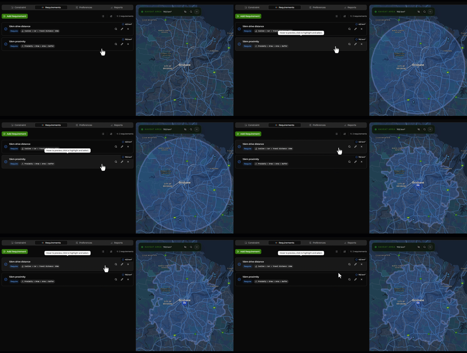
The distinction matters because a straight-line number can sound like access. A property may be 30 kilometres from a city centre and still require a long detour to reach a bridge, motorway entrance or usable public transport connection. The distance is real. It simply answers a narrower question than many buyers assume.
What the listing says and what you still need to ask
| Location pattern | Potential upside | Potential trade-off |
|---|---|---|
| 30 km to the CBD | A clear geographic comparison between two points | May be straight-line distance; it does not describe the road, rail or walking route |
| 1 km to Kings Park | The property may be close to some part of a large public park | The park has many entrances, paths and destinations; the advertised point may not be the outlook or facility you care about |
| 30-minute drive to work | A useful estimate when its departure time, route and traffic assumptions are clear | A quiet off-peak result may say little about a weekday school or commuter trip |
| Short walk to cafes | There may be hospitality within walking distance | “Short” leaves the distance, route, crossings, hills, opening hours and destination undefined |
| Map pin near transport | The listing may sit within a useful transport catchment | Illustration, pin placement and straight-line rings can hide the actual entrance, route or barrier |
A kilometre from which part of Kings Park?
Kings Park is a useful Perth example because “1 km from Kings Park” sounds specific while leaving the destination open. The park is a large place with multiple entrances, gardens, bushland, memorials, paths and outlooks. A measurement to the nearest boundary is different from a walk to the State War Memorial, a drive to a car park or a trip to the city view you had in mind.

The same problem appears with beaches, shopping centres, train stations and schools. The named feature may be a polygon, a campus or a precinct rather than one point. Ask which entrance or destination was used, and whether the number is a direct distance or a route.
Thirty minutes depends on the clock
A “30-minute drive to the CBD” can be achievable under light traffic, a favourable route and uninterrupted movement. It may be a Sunday morning result rather than the trip you will make on a wet Tuesday at 8:00 am. Signals, merging, turning, parking, school zones, incidents and queues all consume time that a simple speed-based estimate may not show.
A ten-minute drive to the local school can change at drop-off and pick-up. A quiet secondary street can become a rat-run when the surrounding roads fill, and a viewing scheduled at midday will not show the same movement as the school bell. Visit at the time your household travels, or calculate the trip across several weekday and weekend departures.
Terrain and impedance belong in the measurement
Travel is shaped by more than distance. Hills, stairs, river crossings, missing footpaths, wide roads, traffic lights, protected crossings and one-way systems can change whether a route is comfortable or practical. A walking circle around an address may include land that is close on a map but difficult to reach on foot. Topographic maps and route networks reveal a different geography from a radius.
A pin can suggest more than the map proves
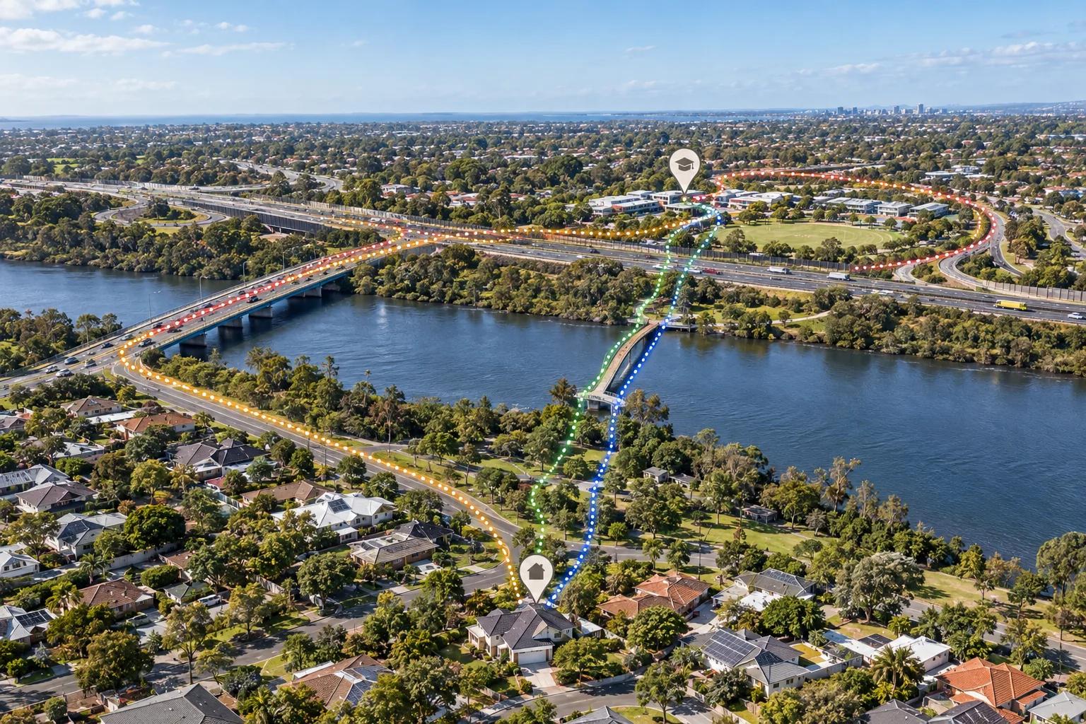
Property marketing also uses artistic licence. A drone image may combine the house, a distant outlook and pins for transport hubs into one persuasive composition. A map may be illustrative rather than to scale. A straight-line ring may be drawn around a landmark even when a river, freeway or rail corridor sits between the property and the destination.
The image may still be useful as an orientation aid. Read it as a prompt to verify the relationship, not as evidence that the view, route or travel time works exactly as pictured.
Use a reachable area instead of a circle
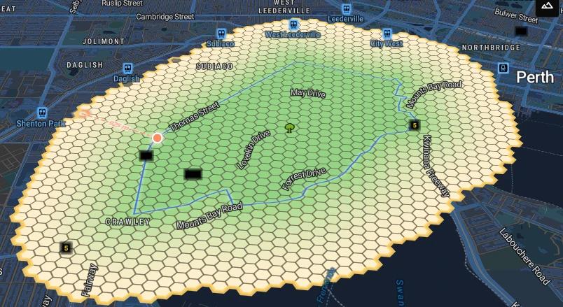
An isoline, also called an isochrone when it represents travel time, maps the area reachable from an origin under a defined mode and threshold. A 30-minute driving isoline follows the road network rather than drawing a perfect circle. Its shape can reflect turn restrictions, crossings, road speeds and the assumptions used by the routing service.
The result is only as useful as its settings. Routing tools can return a typical or daily-average travel time, which sounds sensible because it smooths out unusually fast and slow trips. Weekday congestion may affect only four of 24 hours, while the weekend gives you 48 hours without that weekday peak. Blending those periods can make a route look shorter than the commute or school run you actually make. Check whether the calculation uses speed limits, an average speed or a time-specific traffic model, then compare a weekday peak, a weekday evening, a Saturday morning and the trip you make most often.
A verification routine for the shortlist
- Name the exact destination: an entrance, platform, school gate, car park or lookout, not only the feature's broad name.
- Separate straight-line distance, route distance and travel time. They answer different questions.
- Run the route at the times you will travel, including weekday peaks, school periods and a normal weekend.
- Check the mode, speed assumptions, traffic source, terrain and barriers that shape the result.
- Review planned road upgrades and maintenance along the route. A widening may promise future time savings, while lane changes, detours and construction traffic create significant delays during the stated works period, which could last 18 months or more.
- Visit the route and the address when the listing's claim matters most to your routine.
Make the assumption visible before you buy
The best case is that the advertised number is accurate and survives your checks. The worst case is accepting a convenient estimate, moving in and discovering that the route only worked at an hour you will never travel.
Kaveat helps you make the location relationship explicit before a listing takes over the decision. Use a Requirement when a route or travel threshold is firm. Use a Preference when distance, access or travel time is one trade-off among several. Compare the assumptions across shortlisted addresses, then return to the route, the street and the relevant official information.
Distance is not a promise. Time is not a constant. Both become useful when you can see what was measured, how it was calculated and whether it matches the life you are planning there.
Sources and further reading
- ACCC: False or misleading claims
- ACCC: Real estate
- NSW Government: Misrepresentation information for property agents
- NSW Government: Advertising guidelines for property agents
- Consumer Affairs Victoria: Advertising and representations
- Kings Park and Botanic Garden
- Google Maps
- Geoscience Australia: Topographic maps